Jennifer Orton (@jorton) and I met at ADE institute in 2023 and have been working on compiling lessons for high school teachers using MacBooks or iPads in class. Jennifer uses iPads, and I use MacBooks, and in our collaboration, we realized that small adjustments can be made to apply the lessons in each environment. Over the next 30 days, we’ll post one lesson idea each day!
Lesson Idea #16: Using Apple Maps
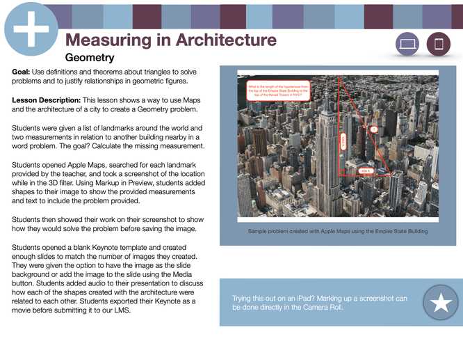
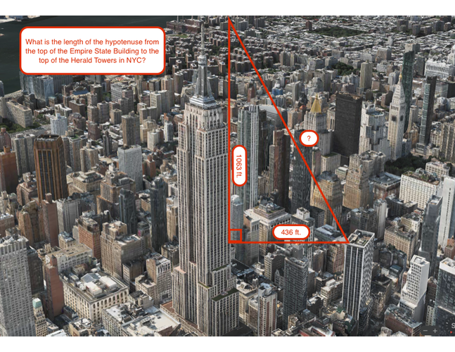
Every teachers favorite question from a student is "When am I ever going to use this?". By using Apple Maps to show measurements between buildings and heights, students can use their geometric formulas to calculate missing sides and angles of triangles in the real world.
Students searched for each provided landmark in Apple Maps and took a screenshot while using the 3D filter/mode. All work was then completed on that screenshot and added to a Keynote slide.
By using Apple Maps, we also help students gain some identifying knowledge of landmarks around the world.
📣 How could you use Apple Maps in your classroom?


December 17, 2024
What an awesome application of the Pythagorean Theorem in the real world!
This action is unavailable while under moderation.
This action is unavailable while under moderation.